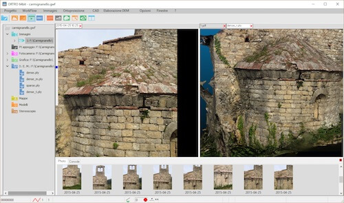
Anyone can take your photos
It automatically recalculates the shooting position for each frame and it allows you to measure with a simple point-and-click
In your survey you can take all the photos you need. Once back to your office, you can easly decide what are the points you want to measure and how to measure them.
You can use your data at a later time if you need to carry some measures that had not been planned

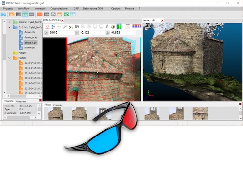
From a set of 2D images you can reconstruct a 3D model perfectly scaled, in the form of a dense points cloud or texturized meshes. You can navigate your model in a 3D view and you can integrate your points with external clouds, generated for instance, by a laser scanner.
If you wish you can acquire directly on the points cloud
From the photos you build a points cloud used to get 3D coordinates from your 2D images. But if you want to get accurate and professional measures the points cloud is not enough; ORTRO assist you giving you advanced techniques of acquisition:
ORTRO automatically prepares the images for the type of measurement you wish to use. For example searching homologous images and allowing you to choose the homologous points, or, in the case of stereoscopic measurement, prepares the stereo pairs, performing epipolar resampling with the correct rotation of the frames
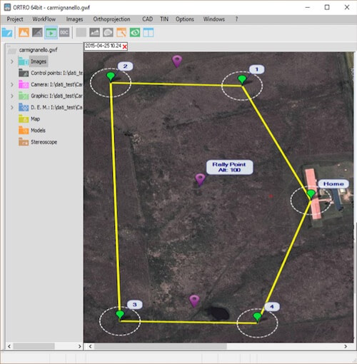
If you want to use a drone for your survey ORTRO can make the flight plan and send it directly to your drone.
You just draw the polygon, the flight coverage on the map, the starting position and the accuracy you want.