Find out how it works

Product Features

Aligne

Projection centre reconstruction SFM Image alignement and sparse points cloud
ORTRO - Projection centre reconstruction

When you create a new project and loads the images, ORTRO reads the EXIF data of each frame, if they exists, and identifies the type of the sensor of the camera. It is possible now to calculate the position of the projection centre of each photo, building a 3D model perfectly scaled. This process, called alignement, is fully automatic.

As a result of the alignement we get also the calibration of the camera, the estimate of the internal lens parameters:

  • The focal length: Distance in pixels or millimeters from the projection center to the image plane of the sensor.
  • The principal point: The image of the projection center on the image plane.
  • The distortion: calculated according to the Brown model with three or five parameters.

As a result of the alignment we get also the so called sparse points cloud formed by the set of 3D points used to calculate the projection centers of the photos.

It is already possible to measure on the pictures, in the sense that at each point of an image, which appears at least on another frame, can be assigned a three-dimensional coordinate. These coordinates, although different from the real ones, are perfectly scaled to each other.

ORTRO can also import the alignment data obtained with other popular commercial softwares.

Feature Two

Georeferencing and Incremental Bundle Adjustment
For georeferencing you have to measure, on the field, the coordinates of some control points

After the alignment of the images ORTRO can reconstruct a three-dimensional model, perfectly scaled, of reality, the scale is not deducible.

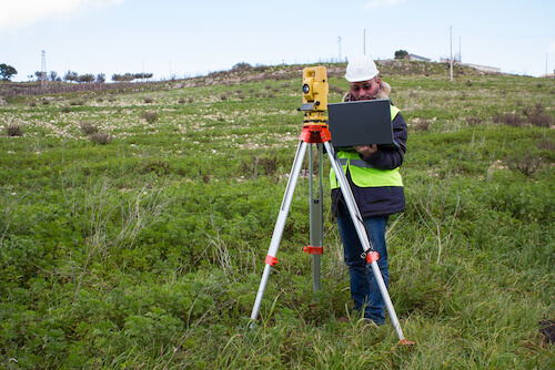
To estimate the exact scale, and introduce a real coordinate system, (Georeferencing), it is necessary to know the measures of two or more points, called Ground Control Point (GCP). We can set these measures manually associating them to the corrisponding pixel of the photos; ORTRO has several methods to simplify this task:

  • Approximate georeferencing. Consists of extracting the coordinates of the projection centers from the EXIF information of each image. This first approximation of the model leads to an automatic raw collimation of each GCP, in the corresponding images.
  • Incremental Bundle Adjustment. Ss performed progressively as you add new GCP to your model; camera calibration and alignement parameters are recalculated in real time. This minimizes the parallax residuals, and significantly increases the accuracy and the precision of measurements.
  • The statistical measure of residuals.The georeferencing procedure produces always optimal or sub-optimal results and the highest quality possible, however the degree of congruence between the alignement and the measurements of the GCP can not be known a priori. To fully validate the quality of the model ORTRO provides an estimate of the error, for each control point, through the geometric reprojection technique

The control points can be typed manually or imported via an exchange metafile.

Feature Three

Measure on 3D model homologous images Stereoscopic measure
ORTRO: Stereoscopic - measure

The georeferenced 3D model is ready for measuring. As the original source of the information consists of the images, they remain the most intuitive and effective means for collimating the geometrical details, even though, according to the contexts, different operating modes are available. Ortro supports all possible measurement mode, and gives the possibility to get accurate and precise values in each condition. Here are the main measuring methods supported:

  • Integrated dense points cloud. ORTRO is able to automatically generate a dense cloud of three-dimensional points that models with great accuracy the details that appear in multiple frames. The output resolution is a function of the degree of overlap among the images, but not always, for various reasons, it reaches a uniform level sufficient to obtain the desired accuracy. When this is possible a real three-dimensional coordinate can be associated to each pixels of the image and the data collection can be done using a single image at a time. If you have a high definition laser scanners cloud, ORTRO can automatically import and register it with the one built by the photos, increasing dramatically the precision obtainable.
  • Homologous images. If the dense cloud is not sufficient for a precise acquisition in the area of interest, the relief of some points could be jeopardized. ORTRO provides an alternative technique for the measurement of important points, based on the method of the homologous images. You select the point of interest on one image where it is well visible and ORTRO automatically chooses the other images where the same point can be located collecting its in exact pixel position. The matching on homologous images is done with a sophisticated interactive algorithm-assisted procedure to ensure the minimization of residual errors.
  • Stereo vision. The stereoscopic method is one of the earliest and most established systems for 3D data collection from images. In the ORTRO development team operates the best spcialist in stereovision having realized several stereo photogrammetric applications; many customers have been working with those softwares for many years. The stereoscopic method is particularly effective                                         for images acquired from aircraft or drone, in these cases the overlapping frames, which must exceed 60%, allows to work with pairs of images in a 3D immersive environment obtained wearing                                         special glasses. ORTRO manages a wide collection of stereoscopic equipment, from the simplest ones consisting of just Red Cyan glasses (anaglyph technique) to the most professional that include                                         OpenGL stereoready graphics cards, active and passive eyewear, and virtually every type of screen on the market. The generation of stereo pairs (epipolar resampling and possible rotation                                         of frames) is obtained in a completely automatic way, their consultation takes place at continuous with the use of a control map using two main techniques fixed and moving floating mark.

Data collection is performed in a 3D CAD environment, Vector data can be inported and exported in the most popular vector formats

Feature Four

ontour lines acquisition
ORTRO: contour lines acquisition

Ortro integrates many tools that facilitate the production of professional processed, exported in the most common exchange formats:

  • Coloured dense point cloud.
  • Texturized mesh .
  • Ortho immages.
  • Sections and profiles.
  • Contour linees.
  • Volume calculation.

Start working with ORTRO in three easy steps

1
Sign in

Leave your email and do not worry we will not send you anything without your permission.

2
Download the App

ORTRO is available for Windows 64bit version 7 and following.

3
Start working

Load your images, execute the alignment, geo-reference and begins to measure the world.